
8 Best Route-Tracking Apps for Cycle Tourers in the Balkans in 2026
Quick Summary
The 8 best route-tracking apps for cycle tourers in the Balkans are Komoot, Ride with GPS, OsmAnd, Strava, Maps.me, Bikemap, Gaia GPS, and Garmin Connect. Komoot ranks first because it combines cycle-specific routing, surface-type data (paved, gravel, dirt), offline regional maps, and the largest user-contributed cycling route database covering Slovenia, Croatia, Bosnia, Serbia, Montenegro, Albania, North Macedonia, and Bulgaria.
Comparison Table of the 8 Best Apps
| Rank | App | Primary Function | Best For in the Balkans | Cost |
| 1 | Komoot | Cycle-specific route planning | Multi-country tours with mixed surfaces | Free + paid regions |
| 2 | Ride with GPS | Detailed route building & cue sheets | Self-planned long-distance tours | Freemium |
| 3 | OsmAnd | Offline OpenStreetMap navigation | Rural and mountainous Balkan areas | Free + paid maps |
| 4 | Strava | Activity tracking + heatmaps | Finding popular local cycling routes | Freemium |
| 5 | Maps.me | Free offline maps | Backup navigation without data | Free |
| 6 | Bikemap | Community-shared cycling routes | Discovering tested local tours | Freemium |
| 7 | Gaia GPS | Adventure & gravel mapping | Mountain biking in Albania, Montenegro | Subscription |
| 8 | Garmin Connect | Device sync & route export | Tourers using Garmin head units | Free |
1. Komoot: Cycle-Specific Route Planning for Mixed Terrain
Komoot is a German-developed route planning application designed specifically for cyclists, hikers, and outdoor adventurers, with strong adoption across continental Europe. For cycle tourers in the Balkans, Komoot’s defining feature is its ability to plan routes based on bike type, including touring bike, gravel bike, road bike, and mountain bike, which produces meaningfully different routing decisions for each profile.
Surface Information and Elevation Profiles in Komoot
Komoot displays detailed surface information along every planned route, indicating which sections are paved, which are gravel, and which are unpaved trail. For cycle tourers crossing the Balkans, this surface data prevents the common problem of routing software sending loaded touring bikes onto rough mountain tracks unsuitable for narrow tires. Komoot also generates elevation profiles for each route, which is essential information in countries like Montenegro, Bosnia, and Albania where cycle tours frequently involve climbs exceeding 1,000 meters in a single day.
Why Komoot Ranks Number One
Komoot is ranked as the number one route-tracking app for cycle tourers in the Balkans because it is the only app on this list that combines cycle-specific routing, surface-type intelligence, and large-scale European user adoption in a single platform. Cycle touring across the Balkans involves a mix of paved roads, gravel paths, broken pavement, and unpaved mountain tracks, and Komoot’s routing engine specifically accounts for these surface types when generating turn-by-turn directions.
The Balkans region is also one of Komoot’s strongest coverage areas in Europe, with thousands of user-uploaded cycle tours through Slovenia, Croatia, Bosnia and Herzegovina, Serbia, Montenegro, North Macedonia, Albania, and Bulgaria. This community-contributed database allows cycle tourers to find vetted routes that account for road quality issues, climbs, water sources, and accommodation, which is information that generic mapping apps simply do not capture. Komoot’s offline region downloads also work reliably in remote Balkan areas where mobile data drops out, making it the most complete single-app solution for cycle touring in this region.
2. Ride with GPS: Detailed Route Building for Long-Distance Tours
Ride with GPS is a route planning and tracking application popular among long-distance cycle tourers and bike club organizers. For cycle tourers in the Balkans, Ride with GPS offers granular control over route building, including the ability to drag and drop waypoints, view turn-by-turn cue sheets, and export routes to GPS devices or other apps.
Offline Navigation and Voice Cues in Ride with GPS
The offline navigation feature in Ride with GPS, available with a paid subscription, allows cycle tourers to download routes for areas without mobile coverage, which is common across rural Bulgaria, central Bosnia, and northern Albania. Voice cues delivered through earbuds let cycle tourers follow turn-by-turn directions without removing their hands from the handlebars or looking down at their phone, a safety advantage on narrow Balkan roads shared with vehicles.
3. OsmAnd: Offline OpenStreetMap Navigation for Rural Balkans
OsmAnd is an offline navigation application built on OpenStreetMap data, which is community-edited and tends to be particularly detailed in Eastern Europe and the Balkans. For cycle tourers traveling through Serbia, North Macedonia, or rural Bulgaria, OsmAnd often shows small village roads, unpaved tracks, and shortcuts that commercial maps such as Google Maps omit entirely.
Why OsmAnd Works Well for Balkan Cycle Touring
OsmAnd works well for Balkan cycle touring because its cycling routing profile prioritizes bicycle-friendly roads, marked cycling routes, and known EuroVelo corridors that cross the region. The EuroVelo 6 (Danube route through Serbia and Bulgaria), EuroVelo 8 (Mediterranean route through Croatia and Albania), and EuroVelo 13 (Iron Curtain route) all pass through the Balkans and are well-tagged within OpenStreetMap data, making them easily followable through OsmAnd.
4. Strava: Heatmaps for Discovering Popular Cycling Routes
Strava is a fitness tracking application widely used by cyclists worldwide, with one feature particularly valuable for cycle tourers exploring an unfamiliar region: the global heatmap. The Strava heatmap aggregates anonymized GPS data from millions of cyclists, highlighting in bright color the roads and trails most frequently ridden.
Using Strava Heatmaps to Plan Balkan Routes
Cycle tourers planning routes through unfamiliar Balkan areas can use the Strava heatmap to identify which roads local cyclists actually ride, which is often a more reliable indicator of road quality and safety than any official map. In countries like Albania and Kosovo, where formal cycling infrastructure is limited, the Strava heatmap reveals locally preferred routes that may not be marked on any commercial cycling map. The heatmap is most useful as a planning tool rather than a real-time navigation tool, and works best when paired with one of the dedicated routing apps in this list.
5. Maps.me: Free Offline Backup Navigation
Maps.me is a free offline mapping application based on OpenStreetMap data that allows cycle tourers to download entire country maps for navigation without mobile data. For cycle tourers in the Balkans, Maps.me functions primarily as a free backup to paid mapping services, providing reliable basic navigation in case Komoot or Ride with GPS subscriptions fail or batteries die on a primary device.
Maps.me Limitations for Serious Route Planning
Maps.me has clear limitations as a primary route-planning tool because it lacks cycling-specific routing logic and does not differentiate between bicycle-suitable and bicycle-unsuitable roads in its directions. Cycle tourers in the Balkans should use Maps.me as a secondary navigation aid, particularly for locating village shops, water sources, and accommodations marked on the map, rather than relying on it for primary cycling route guidance.
6. Bikemap: Community-Shared Cycling Routes
Bikemap is a cycling route database and route-planning application built around a community of cyclists who upload and share their completed routes. For cycle tourers in the Balkans, Bikemap provides access to thousands of pre-existing routes uploaded by local and visiting cyclists across the region.
How to Use Bikemap for Balkan Trip Planning
Cycle tourers planning a Balkan trip can use Bikemap to search routes by region, distance, and difficulty, then filter for routes uploaded within the last few years to ensure the road and trail conditions remain current. The Bikemap Premium subscription unlocks offline route downloads and voice navigation, which become necessary in mountainous Balkan regions where mobile coverage is unreliable. Bikemap is most valuable as a discovery tool for finding routes that have already been ridden and verified by other cyclists, rather than as a tool for building original routes from scratch.
7. Gaia GPS: Adventure Mapping for Gravel and Mountain Routes
Gaia GPS is an outdoor adventure mapping application originally built for hikers and overland drivers but increasingly popular among gravel cyclists and bikepackers. For cycle tourers pursuing off-road or mixed-surface routes through the mountains of Albania, Montenegro, Bosnia, and North Macedonia, Gaia GPS offers map layers that other cycling apps do not provide.
Specialized Map Layers in Gaia GPS
Gaia GPS includes specialized map layers such as topographic maps, satellite imagery, and trail-specific overlays that help cycle tourers identify whether a route crosses a goat track, a forest service road, or a paved climb. These map layers are particularly useful in the Dinaric Alps and the Albanian Alps, where loaded cycle tours sometimes need to assess whether a planned mountain crossing is rideable or requires hike-a-bike sections. Gaia GPS is sold through a paid subscription model and is most valuable for cycle tourers planning gravel or bikepacking-style trips rather than paved road tours.
8. Garmin Connect: Device Sync for Garmin Head Unit Users
Garmin Connect is the companion application for Garmin GPS devices, including the Edge series of bicycle head units commonly used by long-distance cycle tourers. For cycle tourers in the Balkans who carry a dedicated Garmin device on the handlebars, Garmin Connect provides the link between phone-based route planning apps and the head unit display.
Why Dedicated Head Units Matter for Balkan Cycle Tours
Dedicated Garmin head units matter for Balkan cycle tours because phone batteries drain quickly when used for all-day navigation, and Balkan accommodation sometimes lacks reliable power outlets in rural guesthouses. A Garmin head unit can run for 15 to 20 hours of active navigation on a single charge, allowing the cyclist’s phone to remain reserved for communication and emergencies. Garmin Connect allows routes built in Komoot, Ride with GPS, or Bikemap to be synced wirelessly to the head unit, making it the bridge that connects all the planning tools listed above to the device actually mounted on the bike.
Final Notes on Choosing Apps for Balkan Cycle Touring
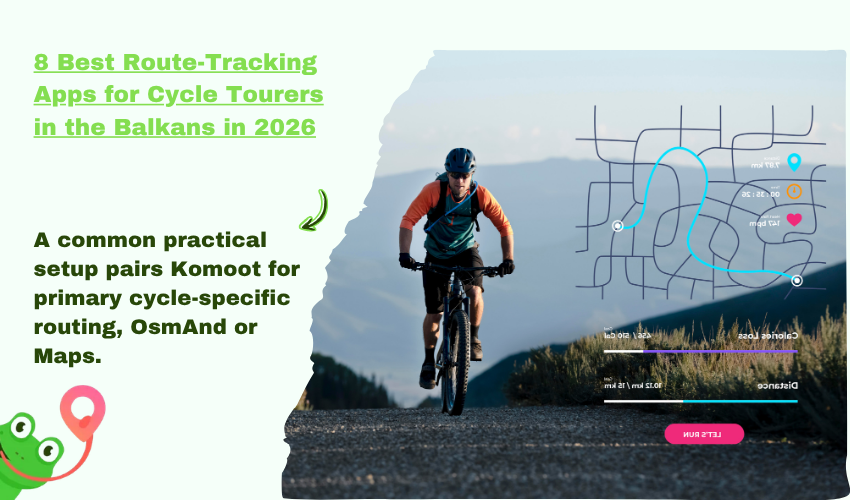
Cycle tourers riding through the Balkans benefit most from combining two or three of these eight apps rather than relying on any single tool. A common practical setup pairs Komoot for primary cycle-specific routing, OsmAnd or Maps.me as offline backup, and Strava heatmaps for discovering local route options. Subscription costs for paid features such as Komoot region packs, Ride with GPS offline maps, or Gaia GPS premium layers are typically small relative to the cost of a multi-week Balkan tour and consistently justify the expense when riding through remote regions of Albania, Bosnia, and North Macedonia. Each of these eight apps fills a different role within the route-tracking workflow, and the right combination depends on the cycle tourer’s bike type, route style, and tolerance for off-grid navigation.
