
Crete’s Hidden Gems You Can Only Reach by Car
The version of Crete nobody puts on a postcard
Here’s the thing about Crete that the brochures won’t tell you: the island is enormous. Like, genuinely, surprisingly large – 260 kilometers from one end to the other, with a spine of mountains running through the middle and a southern coastline that faces Africa and couldn’t care less about tourist infrastructure.
Most people experience maybe 15% of it. They book a resort near Heraklion or Chania, take the shuttle to Knossos, pick up some olive oil at the airport, and leave. They had a fine time. The weather was great.
But the other 85%? That’s where the island gets strange and beautiful and a little hard to explain to anyone who wasn’t there.
And almost none of it is reachable without a car.
Freedom is a set of keys and a full tank
Crete’s bus network does what it needs to do – which is connect the big northern towns on a schedule built for commuters, not wanderers. Taxis work fine for hotel-to-restaurant runs. For everything else, you’re either driving or you’re missing it.
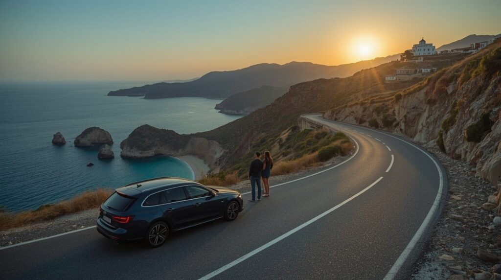
Travelers who sort out car hire Crete before they land tend to approach the island completely differently – not anchored to a resort’s activity board, not dependent on which tour groups happen to be running that week. The mountain roads look intimidating on Google Maps. In practice, they’re quiet, well-maintained, and almost entirely empty outside of high summer mornings.
The trade-off – a small daily rental cost – pays back in full the first time you drive somewhere and realize you’re the only car in the parking area.
Where to actually go
Xerokampos – the beach at the end of everything
There are no signs counting down the kilometers to Xerokampos. The road drops through a gorge, the mountains get drier and more dramatic, and then – suddenly – there’s a beach. Not a famous beach. Not a beach with a bar or a rental umbrella in sight. Just sand, and water that’s this implausible blue-green color that makes the Mediterranean look like it’s showing off.
From Ierapetra, it’s roughly 90 minutes. The mountain roads are paved and in decent shape, though they’re narrow enough in places that passing a truck becomes a minor negotiation. It’s worth every slow kilometer.
Xerokampos faces east, which makes it exceptional for sunrise – a piece of information that’s only useful if someone is willing to get up early enough, which, honestly, not everyone will be.
Aradena Gorge – Samaria for people who hate queues
Samaria Gorge is magnificent. It’s also 16 kilometers of Europe’s longest ravine that, in July and August, you share with what feels like everyone currently in Greece. The wooden walkways, the gift shops at the bottom, the organized boat back – it’s all very well done. It’s also, at this point, a managed tourist experience.
Aradena is different. The gorge starts at a village that was abandoned in 1948 – evacuated after a feud between local families turned violent and never really recovered. The ruins are still there. A metal bridge spans the gorge at the top, the kind that sways enough to remind you it’s there. The descent takes 2–3 hours through steep terrain and rock formations that look like something a film set designer would reject for being too dramatic.
The hike ends at a small beach on the Libyan Sea, where a boat taxi runs to Loutro – a village with no road access, no cars, no scooters, just a row of tavernas on the waterfront and the quiet that comes from genuine inaccessibility.
Getting to the Aradena trailhead means driving through the Sfakia region on roads carved through the White Mountains. There is no alternative.
Therisso Gorge – the one you drive through, not hike
Not every hidden gem demands hiking boots and a 6am alarm. Therisso is 15 kilometers from Chania – twenty minutes, maybe less – and the experience of driving through it is the point. Limestone walls rise on both sides, the road narrows, and there’s a particular quality of light in the gorge that doesn’t photograph well but feels significant in person.
At the far end, the village of Therisso sits at 580 meters. It’s small, historically weighted (a major revolt against Ottoman rule kicked off here in 1905), and home to several good tavernas where the menu sometimes involves a conversation rather than a laminated card. This pairs well with a stop at Aptera, an archaeological site 30 minutes east – Roman cisterns, Byzantine remnants, and panoramic views over Souda Bay that most visitors to Chania never see, despite being extremely close.
Kolokitha Beach – eastern Crete’s quietly excellent secret
The directions to Kolokitha involve a historic stone bridge, some windmills, a dirt track, and the chapel of Agios Loukas. After parking, a 5–10 minute walk leads to a cove with shallow, clear water and the kind of calm that suggests the beach hasn’t quite been discovered yet – which, relatively speaking, it hasn’t.
It’s best folded into a day around Elounda and Agios Nikolaos, two towns in eastern Crete that together offer the island’s most sophisticated waterfront scene alongside some genuinely excellent seafood.
Lassithi Plateau – the part of Crete that’s above the heat
The plateau sits at roughly 840 meters, which in practical terms means it’s cooler than the coast in August, surrounded by mountains on all sides, and deeply agricultural in a way that feels genuinely unchanged. Orchards. Windmills. Farmers on tractors who are not particularly impressed by tourists.
The drive up from the north passes through Krasi, where an ancient plane tree stands in the village square – estimated to be over 2,000 years old, which is the sort of number that sounds made up until you’re standing next to it. At the plateau’s eastern end, the Dikteon Cave claims to be the birthplace of Zeus, which is difficult to verify but makes for a good conversation at dinner afterward.
Before heading out – a few things that matter
Mountain driving in Crete is manageable, but it helps to go in prepared:
- Fuel: Stations disappear in the south and east. If the gauge is below half and there’s a station visible, stop.
- Timing: Seitan Limania and Elafonissi at 10am in August look very different from the same places at 7am. The island rewards early starts absurdly well.
- Maps: GPS works, but it occasionally treats goat tracks as navigable roads. Download offline maps from Maps.me or Google Maps before leaving the Wi-Fi zone.
- Vehicle: Standard cars cover almost everything on this list. A higher-clearance option is useful for Red Beach near Matala, where the last stretch is unmade. Worth asking at the rental desk if that’s on the itinerary.
Worth knowing before going
Crete is the kind of place that reveals itself in layers – and the outermost layer, the one visible from a tour bus window or a resort terrace, is genuinely lovely. Nobody’s being cheated by staying near Chania and walking the harbor at sunset. That’s a real and good experience.
But the island underneath that layer is wilder, quieter, and harder to summarize. Mountain villages where the coffee comes with a glass of water and the proprietor wants to know where you’re from. Gorges with no one in them. Beaches that require effort and reward it exactly proportionally.
None of it is especially difficult to reach. The roads are better than they look on paper. The distances are manageable. The only thing actually required is the willingness to drive past the resort zone and find out what’s on the other side – which, as it turns out, is most of Crete.
